Epperson-Brown-Jonischkies Cemetery
Cuero, DeWitt County, Texas, USA
About
-
- Cemetery ID:
Members have Contributed
Advertisement
Photos


The cemetery is listed as Epperson-Brown-Jonischkies Cemetery in the DeWitt County Cemetery book, but it is also referenced by the following names in various death certificates:
Brown Cemetery
Caruthers Cemetery
Jonischkies Graveyard
12 Mile Cemetery
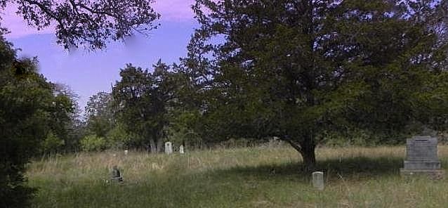
The cemetery is located in the area of the Rabke Church in DeWitt County, TX. About one mile south of the church, turn right onto Stehle Lane. The cemetery is located on private property to the left of Stehle Lane, about 200 yards back in the woods. The gate to the cemetery is normally locked, so you might want to contact the property owners before driving out to the cemetery site.
Alternate directions to its location: from Cuero, take US 183 southwest about 3 miles, take FM 2718 southwest about 6.5 miles go west 3/10 mile (note that these directions will only get you to the point on Stehle Lane where you need to turn left for another 200 yards onto private property).
The map location shown here is based on the exact location of the Texas Historical Marker at the grave of Allen Caruthers (1804-1863) who was a veteran of the Battle of San Jacinto. You can enter these coordinates into your GPS device to help navigate to the exact location of the cemetery: N 28.985749 W -97.397763
The cemetery is listed as Epperson-Brown-Jonischkies Cemetery in the DeWitt County Cemetery book, but it is also referenced by the following names in various death certificates:
Brown Cemetery
Caruthers Cemetery
Jonischkies Graveyard
12 Mile Cemetery
The cemetery is located in the area of the Rabke Church in DeWitt County, TX. About one mile south of the church, turn right onto Stehle Lane. The cemetery is located on private property to the left of Stehle Lane, about 200 yards back in the woods. The gate to the cemetery is normally locked, so you might want to contact the property owners before driving out to the cemetery site.
Alternate directions to its location: from Cuero, take US 183 southwest about 3 miles, take FM 2718 southwest about 6.5 miles go west 3/10 mile (note that these directions will only get you to the point on Stehle Lane where you need to turn left for another 200 yards onto private property).
The map location shown here is based on the exact location of the Texas Historical Marker at the grave of Allen Caruthers (1804-1863) who was a veteran of the Battle of San Jacinto. You can enter these coordinates into your GPS device to help navigate to the exact location of the cemetery: N 28.985749 W -97.397763
Nearby cemeteries

Upper Meyersville, DeWitt County, Texas, USA
- Total memorials102
- Percent photographed85%
- Percent with GPS0%
Yorktown, DeWitt County, Texas, USA
- Total memorials0
- Percent photographed0%
- Percent with GPS0%
Yorktown, DeWitt County, Texas, USA
- Total memorials8
- Percent photographed25%
- Percent with GPS0%

Upper Meyersville, DeWitt County, Texas, USA
- Total memorials2
- Percent photographed100%
- Percent with GPS50%
- Added: 22 Aug 2013
- Find a Grave Cemetery ID: 2509424

Cemetery Photos
This is a carousel with slides. Use Next and Previous buttons to navigate, or jump to a slide with the slide dots. Use Escape keyboard button or the Close button to close the carousel.


Success
Uploading...
Waiting...
Failed
This photo was not uploaded because this cemetery already has 20 photos
This photo was not uploaded because you have already uploaded 5 photos to this cemetery
This photo was not uploaded because you have already uploaded 5 photos to this cemetery
Invalid File Type
Birth and death years unknown.
1 photo picked...
2 photos picked...
Uploading 1 Photo
Uploading 2 Photos
1 Photo Uploaded
2 Photos Uploaded
Size exceeded
Too many photos have been uploaded
"Unsupported file type"
• ##count## of 0 memorials with GPS displayed. Double click on map to view more.No cemeteries found